The jet stream exposed Europe to prolonged heat
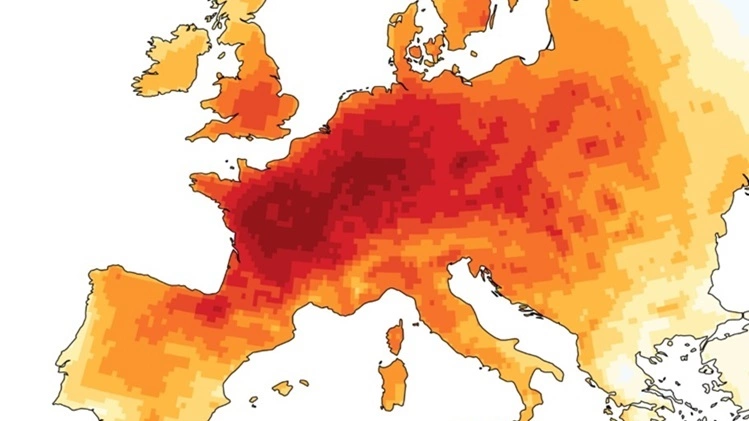
The constantly changing jet stream can trap warm air above Europe, leading to heat waves lasting two weeks or more. According to Prevention Web, jet streams are bands of wind concentrated in the upper atmosphere, moving around the Earth in the Northern and Southern Hemispheres. Their exact location is not fixed, can shift north or south and change direction in response to changes in location and intensity of high pressure and low pressure weather systems. According to New Scientist, because there is only daily atmospheric data for about 20 long-term heat waves, Duncan Pappert, a PhD student at the University of Bern in Switzerland, and his colleague Olivia Martius, simulated 1,900 short-term heat waves using advanced climate modeling and analysis. They found that these hot periods are often influenced by two types of atmospheric patterns. In both types, Rossby waves modify the polar jet stream, a belt of strong winds aloft at about 60 degrees north latitude. Rossby waves are giant undulations in the Earth's atmosphere and oceans, formed by the planet's rotation and playing a pivotal role in global temperature regulation by moving warm air toward the poles and cold air toward the equator. In type 1, the jet stream becomes more wavy, curving north around Britain and Scandinavia before veering south, forming a shape resembling the Greek letter omega (Ω). A persistent high pressure trough forms in this omega block, creating persistent heat dome conditions above Western Europe. Instead of breaking through the trough, storms from the Atlantic strengthen the low-pressure cyclonic circulation at the head of the omega block, pulling warm air from the subtropics northward as it rotates.
In type 2, the jet stream moves towards the poles, then towards the north of the UK but in a more direct path, trailing a high pressure trough that forms over Europe. Storms move along the jet stream, redirecting low pressure systems north of the continent while hot air from the subtropics rushes in from the south.
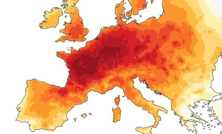
The two cases mentioned above both resulted in heat domes operating non-stop in Western Europe. On Earth's surface, air moves from high pressure systems to low pressure areas. As dry air descends from above, it is compressed and heated, similar to the process of inflating a bicycle tire. Moist air cannot rise to form clouds, so the sky is clear and sunlight continuously heats the lower atmosphere. Sunlight also heats the ground, drying the soil and reducing evaporation, creating a continuous cycle. These two types of jet models are common trends and are not absolute. According to Pappert, the heat dome behind the record heat wave in June that killed about 20,000 people in Europe was type 2 before transforming into type 1. The current heat wave in Europe is largely similar to type 1, with a low pressure trough to the west of the high pressure trough above Europe. Heat waves that last at least a week are more dangerous than events of a few days because the human body is under pressure for longer. Infrastructure such as hydroelectric dams and agriculture are also affected. Understanding atmospheric patterns can help experts issue early warnings about prolonged heat waves, giving people, businesses and authorities more time to prepare for response. Heat waves are becoming more intense, frequent and longer lasting as global warming is raising background temperatures. According to research published in 2022 in the journal Nature Communications, heat waves in Europe increase 3-4 times faster than other places in the mid-latitudes of the Northern Hemisphere such as the US or Canada. Some studies indicate jet-related high-pressure blocking will become more common and persistent in Europe while other models suggest a change. The jet stream is starting to shift north, which could bring drier conditions to southern Europe. If patterns 1 and 2 appear more often or last longer, it will cause great damage to the economy and human health.
The World Meteorological Organization (WMO), the UN's specialized agency for weather, climate and water resources, warns the world to prepare for the upcoming return of El Nino. This phenomenon can cause strong weather fluctuations. Not only Europe, Asia is also expected to be one of the areas heavily affected, when increasing heat and drought can put great pressure on agriculture, power grids and water sources.