The United Nations adopts a new world map
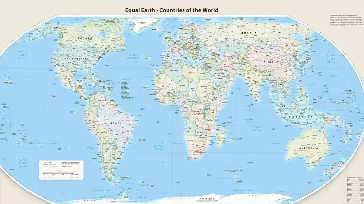
CNN reported that on September 4, the United Nations General Assembly voted to approve a new world map to reflect the actual size of the continents, correcting errors in traditional maps that make Africa and areas near the equator smaller than they actually are.
The "Map Correction" resolution put forward by the African Union member states and the Bahamas received overwhelming support with 164 countries voting in favor, 6 countries abstaining (Serbia, Estonia, Georgia, Lithuania, Moldova, Ukraine) and only the US voting against. The new resolution aims to provide a fair perspective for the world's regions, especially Africa. The fact that Africa has been drawn small on maps over the centuries has unintentionally made people think that the continent is smaller than it actually is and less important.
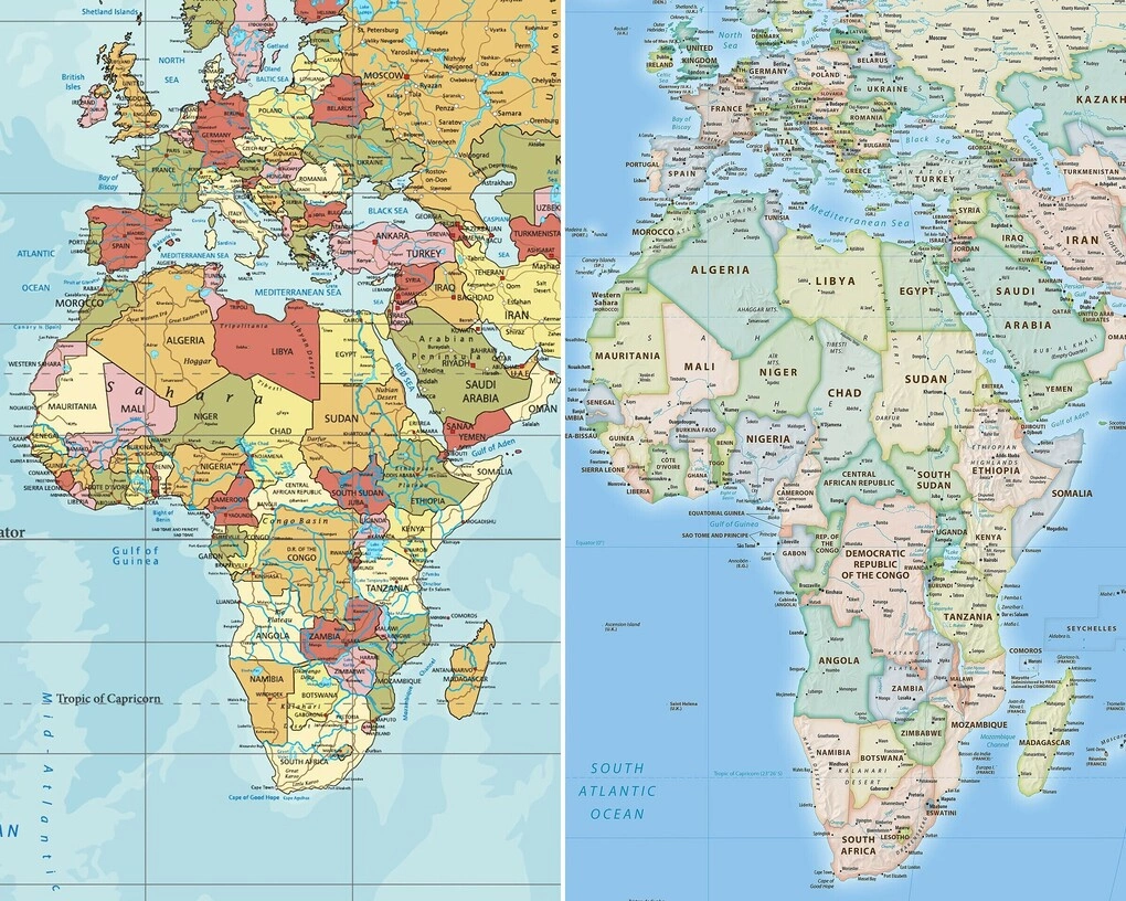
NBC News said many world maps today are based on the Mercator projection created by European cartographer Gerardus Mercator in 1569. The Mercator projection is a method of drawing a world map on a flat surface, in which lines of longitude and latitude are perpendicular to each other, making it easy for ships to orient themselves in a fixed compass direction, so this projection is widely used in navigation. However, it is less useful as a world map because the scale is distorted, with distant countries appearing unreasonably larger than countries closer to the equator. For example, under the Mercator projection, Greenland looks larger than South America and similar to Africa. In fact, Greenland is about the same size as the Democratic Republic of Congo and 14 times smaller than Africa.
Some critics argue that the Mercator projection remains popular because it zooms in and focuses on Europe, as well as other Western regions such as North America. The United Nations resolution expressed concern that the above distortion contributes to the perceived reduction of the size of Africa, Latin America and South Asia and maintains an unbalanced view of the world. In the long term, that contributes to "reducing the socio-economic value, infrastructure needs, development and prosperity potential of the southern region, possibly increasing prejudice in the fields of environment, geopolitics and security".
The "Map Correction" resolution proposes to replace the Mercator projection with the Equal Earth projection based on the Earth's curve, to more accurately describe the relative surface areas of the world's regions. On the Equal Earth map (introduced at the 2018 North American Cartographic Information Association conference), Europe looks smaller, Brazil larger, Greenland significantly smaller, and Africa much larger than before. Jean-Noël Barrot, French Foreign Minister, announced on September 4 that France would abandon the Mercator projection in favor of maps that more accurately depict the surface areas of countries. The UN vote took place after the African Union (AU) adopted the Equal Earth map in March. A month later, on behalf of the AU, Togo asked other UN member states to do the same.
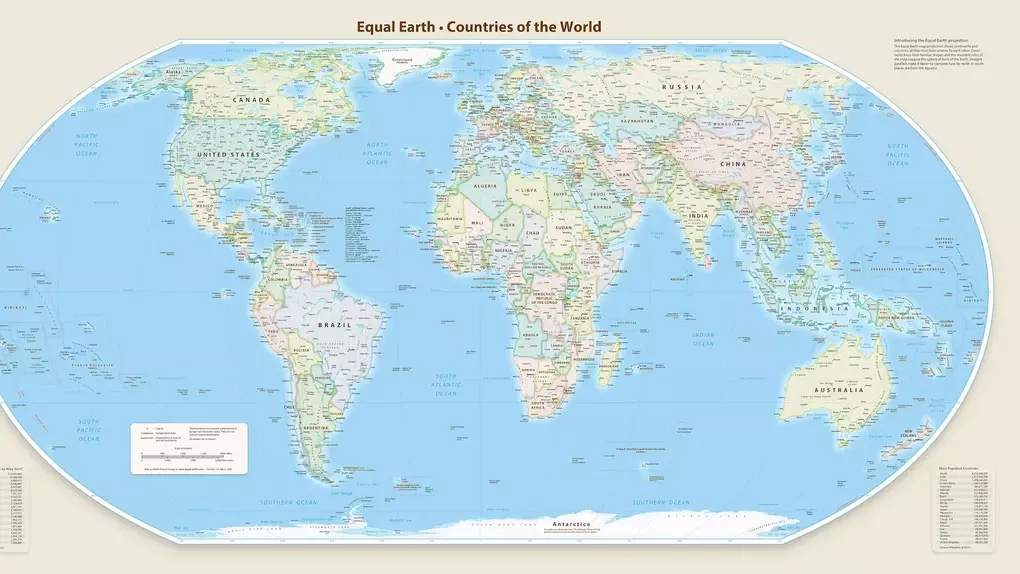
New Zealand has mentioned problems with the Mercator projection when the position in the lower right corner makes the country look like it "disappeared from the world map". The Equal Earth map addresses this problem with various versions, including one centered on Oceania instead of Greenwich, London, which is used as the standard for world time and global geo-referencing.
According to the Guardian, the UN resolution is not coercive, so countries and organizations are not required to use the new projection or prohibited from using the old projection. However, it is expected that the results of the vote may lead to updates to classroom curricula and technology on a daily basis since the Mercator projection is widely used in education, technology, and management.
Many current digital mapping platforms such as Google Maps also use the Mercator projection. The draft resolution calls on the technology platform to cooperate with UN member states and regional organizations to apply more accurate projections.